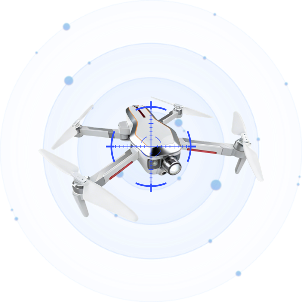
Radar Finds It, Optics Names It: The Confirmation Layer in Counter-Drone
Oct 22 2026
On October 13, 2026, Teledyne FLIR announced the Ranger R10-3DX, a compact counter-drone radar, at an industry exhibition in the United States. The company states a detection range beyond three kilometres against small drones, with a single panel covering 90 degrees in azimuth and up to 60 degrees in elevation, four panels combining into 360-degree coverage, and artificial intelligence classification built in. Delivery is planned for the first quarter of 2027. Those are manufacturer figures, not independent verification, and a buyer should be able to say so plainly.
Three days earlier, on the evening of October 10, operations at Jose Maria Cordova airport outside Medellin stopped at about 22:28 because of a suspected drone and resumed at about 22:45. The regional governor said a counter-drone system was activated and the aircraft was brought down, and that the operator, origin, and intent were still under investigation.
Two events, one technical and one operational, describe the same gap. A radar can tell you that something is up there. It cannot tell you what it is, and the decision that follows depends almost entirely on that second question.
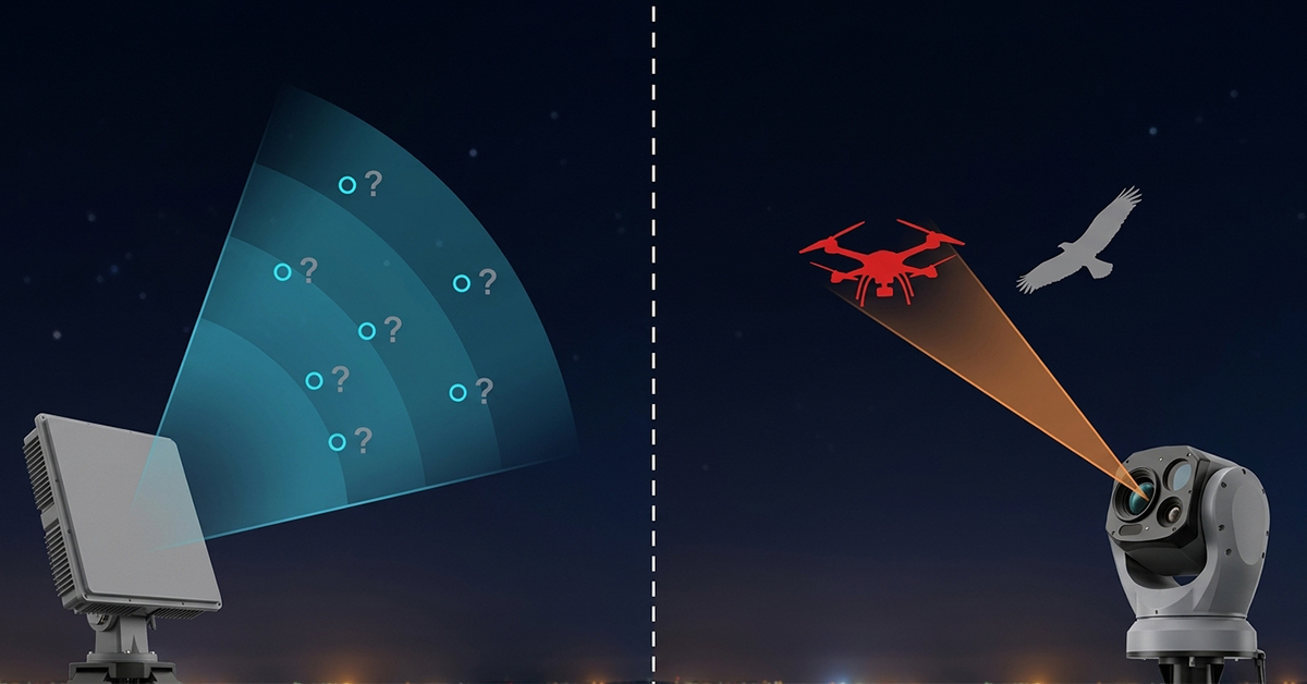
Two Sensors, Two Different Questions
Radar answers questions about physics. Is there an object, where is it, how fast is it moving, in which direction, and is it closing? Those answers are available at long range, in darkness, in fog, and without any cooperation from the aircraft. They are also deliberately unspecific. A radar return from a quadcopter and a return from a large bird can look similar at the edge of coverage, and a return from a delivery drone and a return from a police helicopter can occupy the same track for several seconds.
Optics answers questions about identity. What shape is it, how many rotors, what colour, what is suspended beneath it, which operator is holding a controller, and does the object behave like a machine or a bird? Those answers are specific, and they require a clear line of sight, decent visibility, and enough magnification for the sensor to resolve the object rather than a dot.
Neither sensor produces a decision on its own. The radar produces a candidate. The optical system produces an identification. The confirmation layer is the handoff between them, and its quality decides whether the organisation acts, waits or stands down.
A Compact Radar Number Needs a Condition
The three kilometre figure in the October announcement is a good example of a number that means less than it appears to.
Radar range against small drones is a function of the target’s radar cross section, its altitude, the local clutter environment and the amount of processing the system is allowed to spend on a single detection. A specification quoted without those conditions describes the best case the manufacturer observed, not the range a customer will see from a rooftop in a city.
This is not a criticism of one product. It is the normal condition of the whole category, and it applies to our own hardware as much as anyone’s. The useful discipline for a buyer is to ask four questions of any compact radar: against what cross section, at what altitude, in what clutter, and with what false alarm rate. A radar that reaches a given distance but generates a steady drizzle of false tracks is not a long-range radar. It is a machine that trains operators to ignore it.
The elevation coverage in that announcement is worth noting for a different reason. Sixty degrees of elevation from a single panel matters in urban and airport settings, because the aircraft of concern are often above the horizon line of a flat panel installation and because a site surrounded by tall structures produces returns from an unusual geometry. Coverage in elevation is the specification that quietly decides how much of the sky a site is actually watching.
The Handoff Is the Hard Part
Integrating a radar with an optical system is straightforward in a demonstration and difficult in an installation, and the difficulty is concentrated in three places.
The first is coordinate registration. A radar reports a target in its own frame, the optical system points in another, and the two frames are separated by a mounting offset, an alignment error, and, on a mobile platform, a changing attitude. If registration is off by a fraction of a degree, the optical system looks at empty sky while the aircraft crosses the edge of its field of view. On a fixed mast, this can be corrected once. On a vehicle, it has to be maintained continuously.
The second is time. A radar track and an optical image are useful together only if they describe the same instant. Our own software releases tightened time synchronisation to under one second across the platform, and even that requires care, because a target moving at twenty metres per second travels twenty metres in the interval. The optical field of view at long range is narrow, and a twenty metre error can put the target outside it.
The third is cueing logic. Which track gets handed to which camera, in what order, and what happens when two tracks converge. A system that sends every track to the nearest camera will spend its time slewing between targets and confirming none of them. A system that prioritises by proximity to a protected asset, by closing speed and by track persistence confirms the ones that matter first.
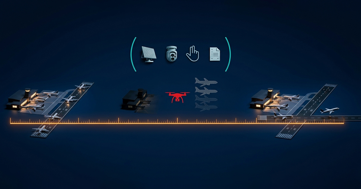
Seventeen Minutes at an Airport
The Colombian event is a useful case because it is short and completely ordinary.
A suspected drone appeared, an airport stopped, a system was activated, the aircraft came down, and operations resumed. Seventeen minutes of closure is a good outcome by the standards of the last few years, where single events have shut airports for hours. It is also seventeen minutes of diverted arrivals, holding aircraft, missed connections, and a regulatory report, and it happened because someone had to make a decision under time pressure with incomplete information.
That is the operational argument for the confirmation layer. The cost of a false positive at an airport is a closure that did not need to happen. The cost of a false negative is an aircraft on the ground or worse. Neither error is cheap, which means the site cannot optimise for sensitivity alone. It has to optimise for the time it takes to turn a candidate into an identified object, and for the confidence attached to that identification when it is made.
A counter-drone installation that reports a detection in two seconds and takes four minutes to confirm it has not solved the airport’s problem. It has moved the uncertainty from the radar operator to the watch commander.
Where Optical Confirmation Sits in a Product Line
Two optical roles need separating, because they answer different questions and are often confused in tenders.
The scanning role belongs to a system that searches on its own. VAR300 carries a 46x identification and tracking lens from 7 to 320 mm and a 23x search lens from 5.9 to 135.7 mm, both at 1920 by 1080, alongside an uncooled 640 by 512 infrared core with a 25 to 75 mm lens. Against a Mavic 3-class target, the reference figures are detection beyond one kilometre and tracking beyond 1.5 kilometres by day, and 0.5 kilometres detection with 0.8 kilometres tracking at night. Azimuth is continuous 360 degrees, elevation runs from 0 to 15 degrees, maximum tracking speed is 120 degrees per second, and the unit weighs up to 37 kilograms in an IP66 housing rated from minus 20 to 60 degrees Celsius. It can separate a multirotor from a bird and hold a bearing to within 2 degrees, which is what makes it useful as a confirmation source when a radio frequency sensor raises the first alarm.
The tracking role belongs to a system that is pointed. T100 is guided by a radar or a radio frequency sensor rather than searching on its own, and it is built to identify and follow what someone else has already found. Its lens runs from 6.1 to 561 mm at 2688 by 1520, with a 5 to 50 mm 4K wide camera and a 640 by 512 infrared core at 15 to 100 mm. Against the same Mavic 3 class target, the reference figures are identification beyond two kilometres and tracking beyond three kilometres by day, and one kilometre identification with 1.5 kilometres tracking at night. On a larger target, the figures extend to four kilometres identification and five kilometres tracking by day. It carries 200 TOPS of local compute, which allows classification on the device and retraining of the model against local conditions. The gimbal covers 360 degrees in azimuth and minus 90 to plus 90 in elevation; the unit weighs 29 kilograms and is rated IP66 from minus 30 to 65 degrees Celsius.
For LZ TECH, the distinction matters in a tender. A site that buys a pointing tracker and expects it to search has bought a system that will only look where someone tells it to look. A site that buys a scanning system and expects long-range identification has bought a system with a wider field of view and a shorter reach. Both are correct purchases for the right job, and both are wrong purchases for the other one.
Building the Layer Without Overselling It
The radar side of this chain is also where the temptation to quote a single figure is strongest, and it is the reason our optical answer is built the way it is. T100 is a pointing tracker, not a searching sensor. It takes a track from whatever radar or radio frequency sensor the site already owns, or from whatever radar the project selects, and turns that track into an identification. The design choice keeps the confirmation layer independent of one radar supplier, which matters both in projects where the radar is still being chosen and in sites that already run a radar they intend to keep.
A tracker that works with one radar is a tracker that forces a sensor purchase. A tracker that accepts a standard track input can be deployed on the customer’s schedule instead of the supplier’s. That difference decides whether an upgrade is a purchase order or a three-year programme.
It also sets the honest limit of what we publish. The radar’s range belongs to the radar, and it depends on the target cross section, the altitude and the clutter of the site it is watching. We do not quote a distance for a radar that has not been selected, because the number would describe a configuration the customer does not own. What can be stated without qualification is the tracker’s own performance, measured against a named aircraft class in stated day and night conditions, which is the set of figures given above.
The layer works when three conditions hold. The radar has enough elevation coverage for the site geometry. Registration between radar and optics is maintained by alignment on a fixed mast and by continuous correction on a vehicle. And the command platform treats a confirmed track differently from an unconfirmed one, so that an operator sees one object with a confidence level rather than two sensors arguing.
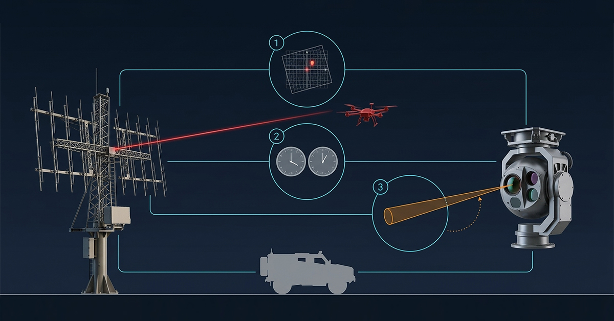
That last point is a design choice with operational consequences. A system that displays a radar track and an optical track as two separate items doubles the workload of the person deciding. A system that fuses them into one object, with radar geometry and optical identity attached, gives that person something they can act on.
The Bottom Line
The market has spent several years competing on detection range, and the October radar announcement is a reminder that range is now a commodity argument. Compact radars with useful coverage and integrated classification are arriving from multiple suppliers, and the differences between them are smaller than the marketing suggests.
The differentiator that remains is the handoff. How quickly a candidate becomes an identified object, how reliably the two sensors agree on where that object is, and how clearly the command layer communicates the difference between a track and a confirmed aircraft. An airport does not close because a radar detected something. It closes because a person decided, and the confirmation layer is what that person’s decision rests on.
Connect with us
Ready to Secure Your Low-Altitude Airspace?