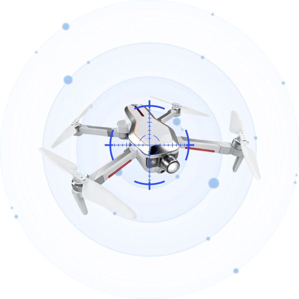
Sovereign Airspace Under Drone Pressure: Building a Layered Low-Altitude Defense
Sep 16 2026
In the opening days of September 2026, several Gulf states reported handling low-altitude aircraft that had crossed into their airspace without authorization. One confirmed it had dealt with a drone over territorial waters on the final day of August. Its neighbors reported similar contacts in the days that followed. The public statements named no model, no intended target, and no method of response. What they shared was a shape: low-altitude contacts arriving in waves, against a backdrop of airspace that is among the busiest and most watched anywhere.
The reports are easy to read as a regional headline. They are more useful read as a specification. Each incident asks the same question that a facility operator faces, scaled to a nation: when something low and fast enters airspace you are responsible for, how do you see it, place it, and decide what to do, before the window to act closes?
A Perimeter That Cannot Be Fenced
A facility can be defended the way a building is: put a fence around it, watch the gates, and respond to what approaches. A nation’s airspace cannot be treated that way. There is no fence, no gate, and no single approach corridor. Airspace is a volume, open on every side, and a low-altitude contact can enter it from any direction, at any hour, along a path that no fixed installation can predict.
That difference changes what the problem is. At a facility, the question is usually whether something is coming toward you. In sovereign airspace, the question is whether anything is where it should not be, anywhere in a volume too large for any single sensor to cover. The shift from a point to a volume is the first thing any airspace protection plan has to absorb.
The Low-Altitude Blind Spot
Most of the infrastructure built to watch a country’s sky was designed for aircraft that fly high, fast, and in predictable lanes. Radar built for that job looks up and out, and it does not see the low, slow, small object close to the ground. A drone flying at rooftop height is small; it moves slowly, and its radar signature is easy to lose in the ground clutter that fills the lowest band of the sky.
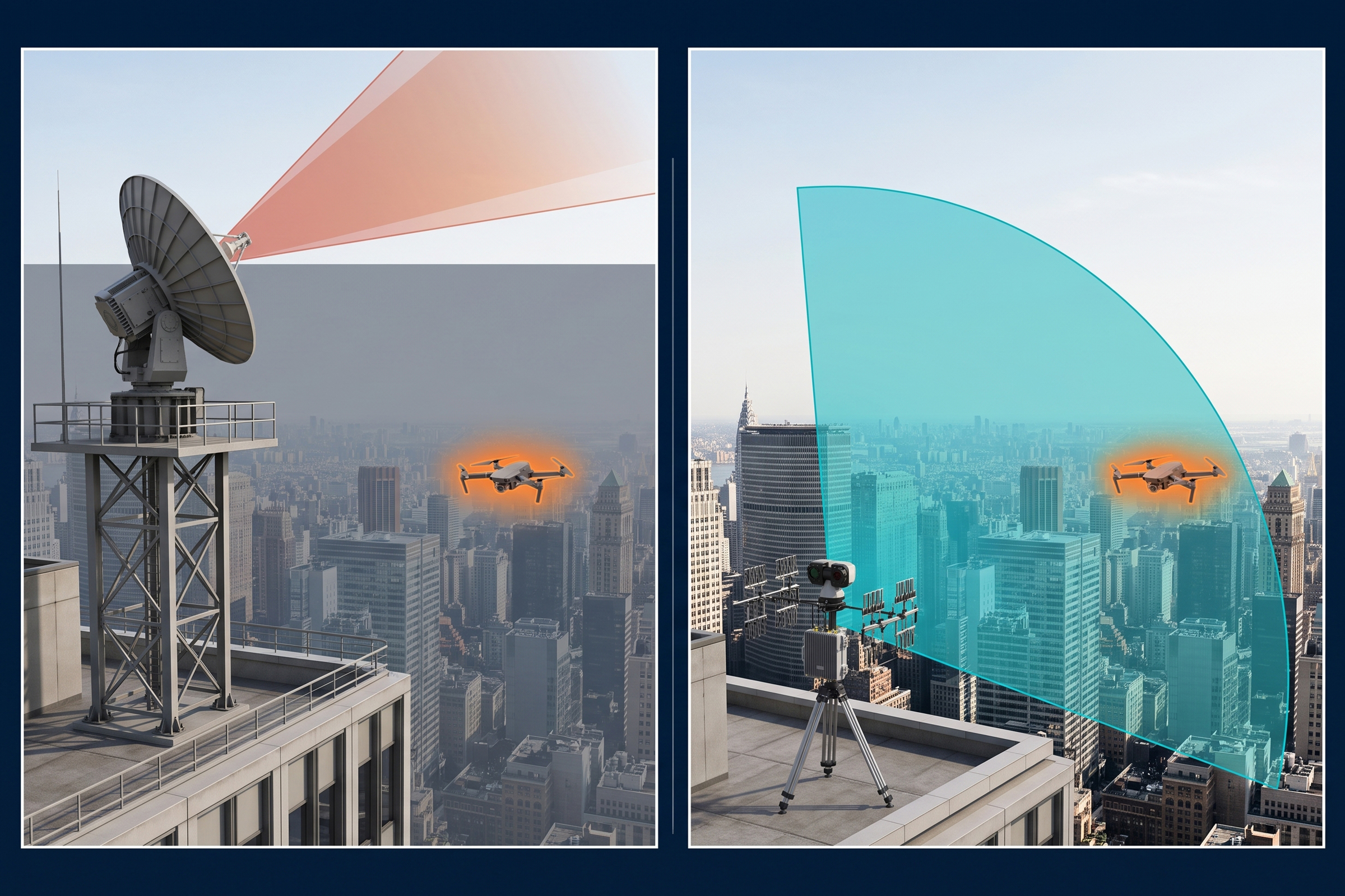
The problem compounds when the contacts arrive in numbers. A single drone is a needle. A wave of them, mixed with other low-altitude traffic, is a needle in a moving haystack, and the operator watching a radar screen has no clean way to separate the genuine threat from everything else. That is the gap the region’s September reports point at: not a lack of will, but a lack of a detection layer built for the low and the small.
Passive Detection as the First Layer
The first thing a low-altitude contact gives away, whether it wants to or not, is its radio signal. A drone has to communicate to fly: a control link, telemetry, and usually a video downlink. All of it is radio energy, and radio energy can be read passively. The DF Series of direction-finding sensors does exactly that. It listens across a broad band, from 30 MHz to 6 GHz, and gives a bearing to the source without transmitting anything itself.
Passive operation matters more in sovereign airspace than almost anywhere else. Airspace of this kind is full of legitimate traffic: civil aviation, communications, the systems of neighboring communities. A detection approach that transmits risks adding noise to an environment it is meant to protect, and it announces its own positions. A passive sensor does neither. It can watch continuously, in a corner of the sky, without anyone knowing it is there and without touching the traffic around it.
Placing the Contact Precisely
A bearing is a start, not an answer. It tells an operator which way to look, but not where the contact actually is, and over a large volume a rough direction is not enough to act on. That is where time-difference-of-arrival, or TDOA, takes over. When the same signal reaches several passive nodes at slightly different moments, the timing differences turn into a position, and the position is precise enough to act on.
The D5-B is a passive TDOA node built for this role. It covers 30 MHz to 6 GHz across a full 360 degrees, detects a drone out to roughly three kilometers at altitudes up to one kilometer, and tracks more than thirty aircraft at once, with positioning accuracy better than ten meters and a response time of about two seconds. At around sixty watts and three kilograms, it is small and light enough to place where the airspace needs it, and to leave running. The difference between a bearing and a coordinate is the difference between looking in the right general area and knowing the contact is over this building, at this moment, which is what a defensible response needs.
One Shared Picture
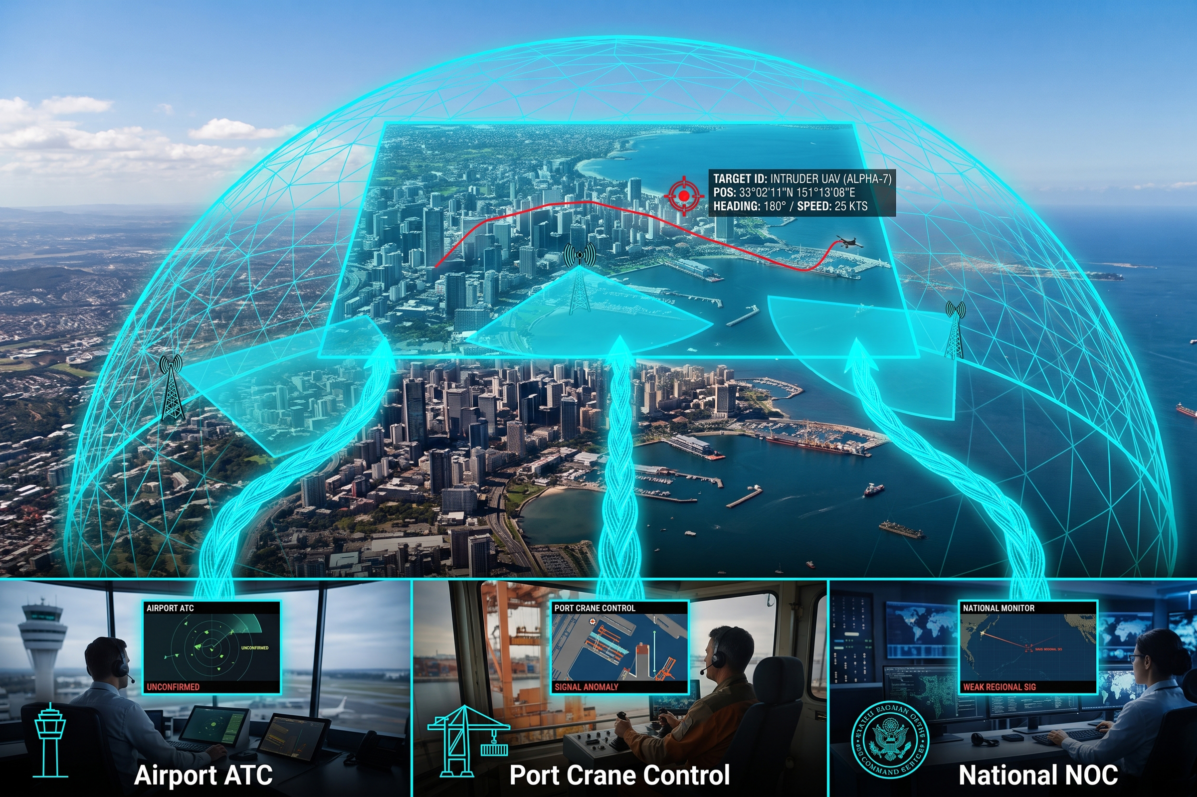
Sovereign airspace is rarely the responsibility of a single operator. Airports, ports, critical sites, and the agencies that protect them each watch their own corner, and a contact moving between those corners can slip through the seams. The September reports describe a wave, not a single contact, and a wave is exactly the case where the seams matter most.

The software layer is what closes them. A command-and-control platform such as CCS fuses the passive nodes, correlates the tracks, and presents one picture to everyone who needs it, whether they sit at an airport, a port, or a national operations center. The hardware sees the contact. The software makes sure the right people all see the same contact, at the same time, with the same position. That shared picture is what turns a collection of sensors into a single airspace picture, and it is the only way a response crosses organizational lines as fast as the contact crosses airspace.
Grading the Response
Not every contact deserves the same answer. Treat everything as a threat, and the response burns itself out on false alarms and stray hobby flights. Treat nothing as a threat, and the one genuine contact is missed. The middle path is grading: let the detection and positioning layers sort the contacts, and reserve the most costly response for the few that warrant it.
Grading matters because the most capable responses are also the scarcest. High-end assets are limited, and a wave of low-altitude contacts is precisely a test of whether the operator can spend them wisely. A layered stack that sees first, places second, and decides third gives the operator the one thing a wave tries to take away: time to grade the contacts and match each to a proportionate response instead of reacting to all of them at once.
The Bottom Line
The Gulf’s early-September reports are a reminder that the low-altitude problem has scaled up from individual facilities to whole airspaces. The sites and nations that answer it are the ones that treat airspace as a volume to be covered, not a point to be fenced. They build the detection layer for the low and the small; they place contacts precisely enough to act; they share one picture across every operator, and they grade the response so the scarce assets go to the contacts that warrant them.
None of that requires a single sensor that sees everything. It requires a network of passive, low-power, precisely-positioning nodes, and a command picture that makes them act as one. The contacts will keep coming from directions that no fence can cover. The question is whether the airspace is read for them before they arrive.
Connect with us
Ready to Secure Your Low-Altitude Airspace?