The Last Kilometer of Drone Defense: From Detection to Visual Proof
Aug 26 2026
Detection Is Not Identification
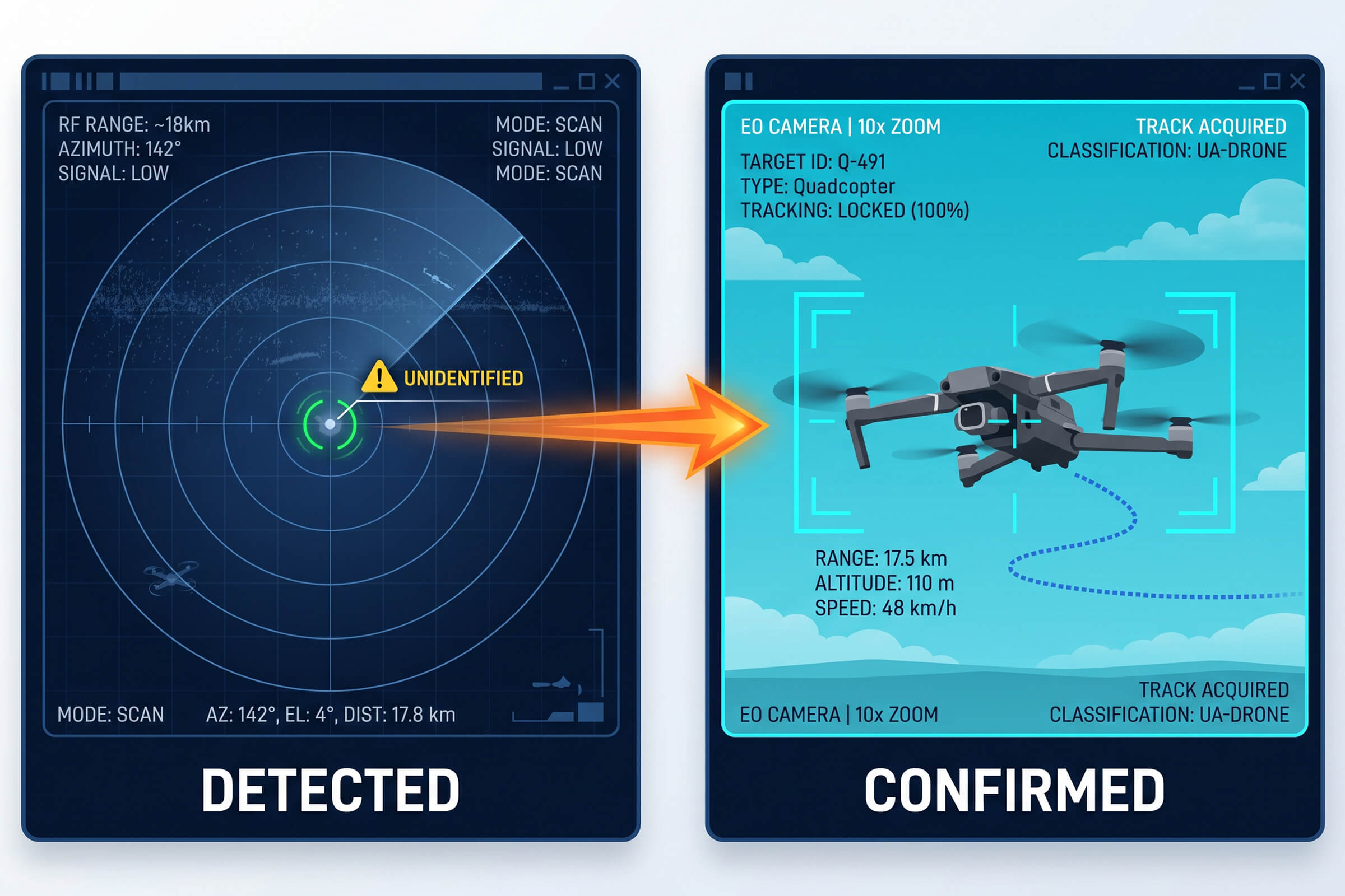
Most drone defense conversations stop at detection. A radio frequency sensor picks up a drone’s signal. A radar unit paints a moving contact. An operator sees a blip on a screen and assumes the job is done. It is not. Detection answers one question, and only one: is something out there? The questions that follow, what it is, where exactly it is, and whether we prove it, are left unanswered.
The gap between a detected blip and a confirmed, documented drone is where most systems quietly fail. A blip cannot be reported to an authority. A blip cannot justify interrupting an event or closing a runway. A blip cannot stand up in an investigation. What turns a blip into something useful is the ability to see the drone, track it, and record what it is doing. That is the last kilometer of drone defense, and it is where electro-optical and infrared tracking earns its place.
Why Seeing the Drone Matters
Three practical reasons make visual confirmation the difference between a sensor and a defense system.
First, false alarms. RF and radar contacts near a busy site are frequently not drones. They are birds, weather returns, legitimate radio traffic, or commercial aircraft passing overhead. Without a visual, the operator cannot tell the difference. Every false alarm that reaches a human desk erodes confidence in the system. Over time, operators learn to ignore the alert that cries wolf, which is the worst possible outcome. Visual confirmation filters the noise before it reaches a decision.
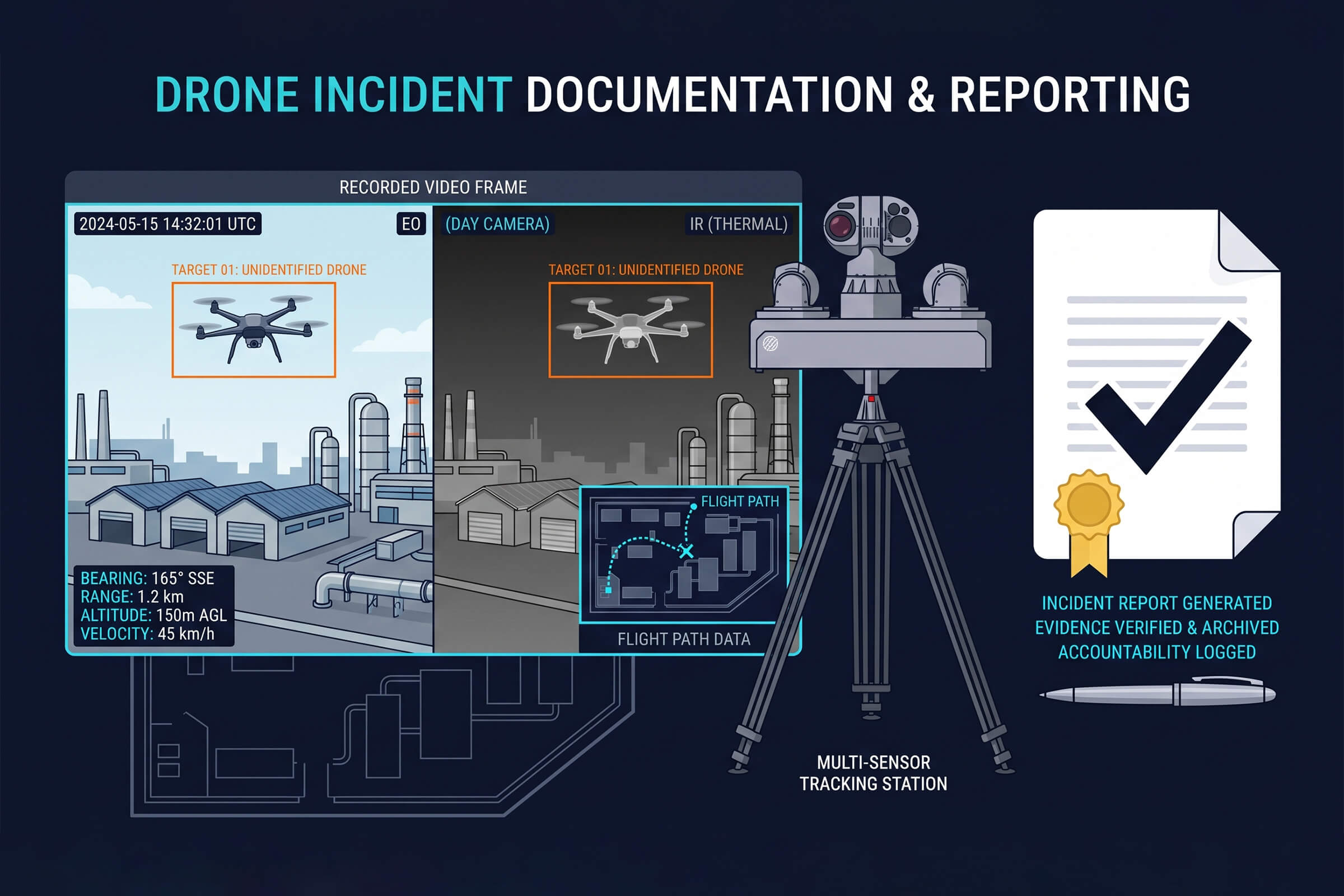
Second, evidence. When an incident happens, such as a drone flying where it should not, dropping a payload, or interrupting operations, the response does not end when the drone leaves. There is a report to write, an investigation to run, and often a legal process to support. An RF log that says a drone was present is weak evidence. A video clip that shows the drone, its flight path, and its behavior is strong evidence. One holds up under scrutiny. The other does not.
Third, the response itself. Knowing a drone is present is not enough to act. The operator needs to know exactly where it is and where it is heading, in real time, to cue any response. A visual tracker provides continuous position. It turns a point-in-time alert into a live track that can be followed, assessed, and acted on.
What an EO/IR Tracker Adds
Electro-optical and infrared systems add exactly the layer that RF and radar lack: a live, visual track of the target. Two capabilities define how well that layer works: how far it can see and how intelligently it can follow.
VAR300: Autonomous AI Scanning
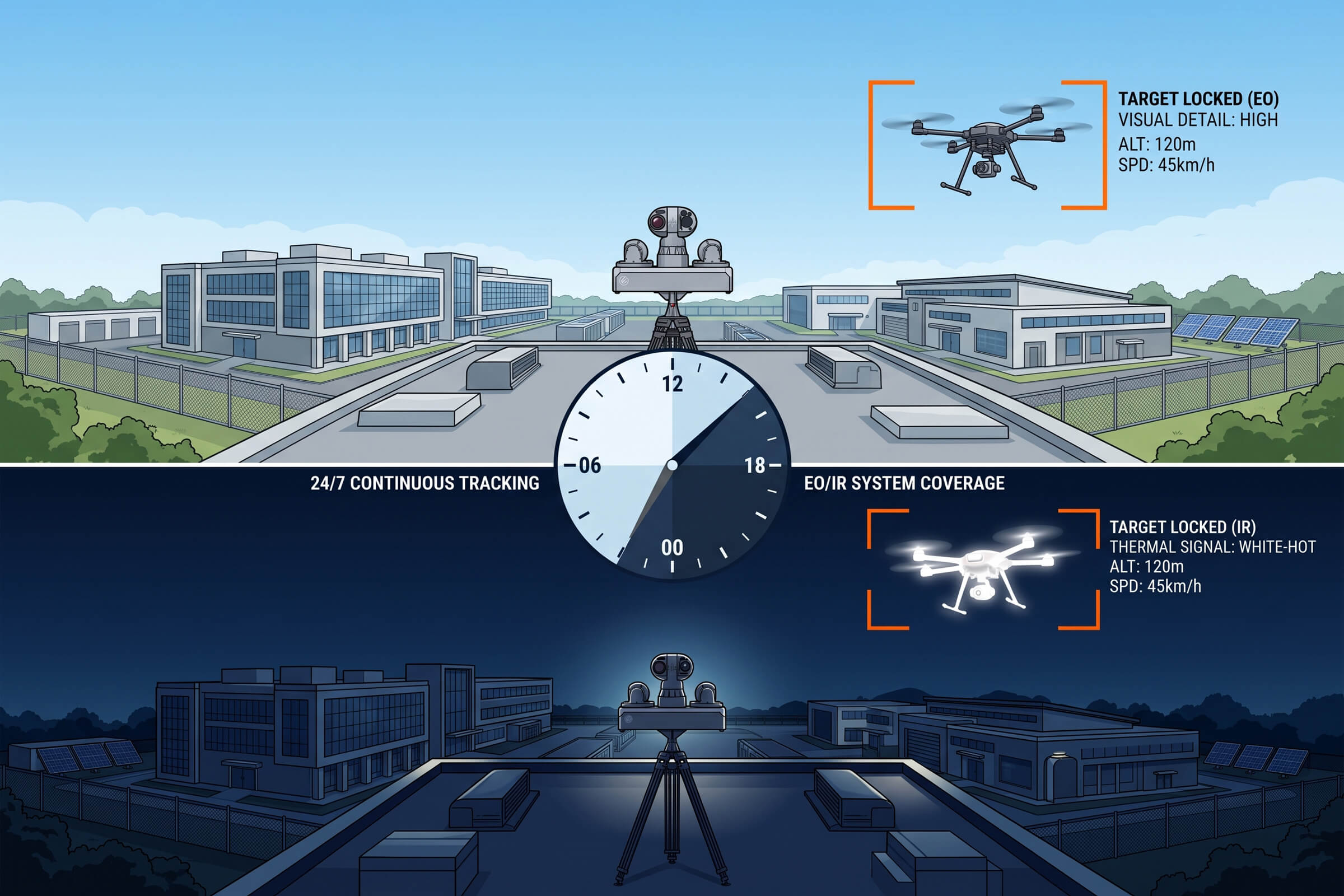
The VAR300 is an all-weather electro-optical and infrared tracker built for continuous surveillance duty. It pairs a 640 by 512 infrared sensor with AI-driven visual tracking to detect and follow drones day and night. During daylight, it detects a drone at up to 1 kilometer and tracks it beyond 1.5 kilometers. At night, the infrared channel takes over, detecting out to roughly 0.5 kilometers and tracking to about 0.8 kilometers. It runs around the clock.
What sets the VAR300 apart is that the tracking is automated. The AI does the watching, so the system does not depend on an operator staring at a screen for the entire shift. It locks onto a moving contact, holds the track, and keeps the camera on the drone as it moves. That autonomy is what makes continuous visual coverage practical, because the human does not have to be the one doing the tracking.
T100: Multi-Source Fusion
The T100 takes the same idea further by fusing radar and radio frequency sensing with dual-spectrum imaging. It combines a visible-light channel with high-definition and high-magnification optics alongside thermal imaging, so it can maintain a visual track at greater range and in more conditions than a single-spectrum tracker. Its multi-source design means the radar or RF layer cues the camera, and the camera confirms what the radar saw.
Onboard edge processing, on the order of hundreds of tera-operations per second, runs the fusion and tracking locally. The result is a system that holds a day-and-night track at ranges reaching several kilometers, without needing to stream everything back to a central server to make sense of it. For sites that need long-range confirmation, the T100 is the answer to the question of what to do when the drone is too far away for a short-range tracker to see.
Closing the Loop: From Alert to Evidence
The full value of EO/IR tracking appears when it is wired into the detection chain. The sequence is simple and repeatable. A radio frequency or radar sensor detects a contact and generates an alert. The alert cues an EO/IR tracker, which slews toward the contact’s position. The tracker locks on, follows the drone, and begins recording. The operator now has a live video track, a documented flight path, and a recording that can be saved as evidence.
This loop is what separates a collection of sensors from a working system. Each layer does what it is good at. RF and radar are good at noticing over a wide area and without visual contact. EO/IR is good at confirming and recording over a narrower field but with certainty. Alone, each is incomplete. Wired together, they cover the whole chain from detection to documented incident.
The recording matters more than most buyers expect. Drone incidents are rarely one-off events resolved on the spot. They generate follow-up: security reviews, regulatory reports, sometimes legal action. A system that produces a clean, time-stamped video record of every incident pays for itself in the quality of the documentation it leaves behind.
The decision is rarely either-or. Many deployments use the T100 for long-range early confirmation and the VAR300 for close-in tracking and coverage of the critical core. The two layers overlap, which is exactly how a visual confirmation system should be built, redundant where it matters and economical where it does not.
The T100 is the long-range answer. By fusing radar and radio frequency sensing with dual-spectrum imaging, it holds a visual track at ranges that a single-spectrum tracker cannot reach. It is the choice for wide-open sites, airfields, ports, and energy facilities, where a drone may first appear far beyond the perimeter, and the operator needs to see it and track it before it gets close. The edge processing keeps the whole chain responsive without streaming raw video to a central server.
The VAR300 is the workhorse for continuous, unattended surveillance at moderate range. Its 640 by 512 infrared channel and AI-driven tracking make it ideal for sites where the drone is expected to appear at closer distances, inside a perimeter, above a facility, over a venue, and where the priority is round-the-clock coverage with minimal operator burden. It watches so a person does not have to.
Not every site needs the same level of visual tracking, and understanding the difference between short-range and long-range confirmation saves money and frustration. The two LZ TECH trackers illustrate the split cleanly.
Choosing the Right Tracker
Where EO/IR Tracking Earns Its Keep
Some sites need visual confirmation more than others. Airports and aviation facilities, where a confirmed drone sighting has immediate operational and regulatory weight. Critical infrastructure, where an intruder’s identity and intent change the response. Event venues and public gatherings, where a documented track supports both security decisions and later review. Correctional facilities, where evidence of a smuggling attempt matters as much as stopping it.
In each case, the pattern is the same. Detection alone leaves the operator guessing. Adding a visual track removes the guesswork. The choice between a detection-only system and one with EO/IR confirmation is really a choice about whether the site needs to know or needs to prove. Most sites that take drone threats seriously need both.
The operators who have run real incidents describe the same thing. The moment that matters is not the first beep on the screen. It is the moment the camera locks on, the picture clarifies, and the operator sees the drone, its shape, its path, and its behavior. That is the moment the situation changes from a vague alarm to a manageable event. Everything before that moment is preparation. Everything after it is a response.
There is a broader point worth making. Drone defense is often described as a sensor problem, and it is, but the sensors are not interchangeable. They answer different questions at different stages. RF answers whether something is there. Radar answers where something is, without identifying it. EO/IR answers what it is, and holds the proof. A system that skips the last stage is a system that notices problems but cannot resolve them.
The T100 pushes the same idea further by combining visible and thermal imaging with radar and radio frequency sensing. When one channel is degraded by weather, another compensates. Radar is not fooled by darkness or fog the way a visible camera is. Thermal imaging sees heat through conditions that defeat visible light. Multi-source fusion is, at its core, a bet against any single channel failing at the wrong moment. That redundancy is what makes long-range, around-the-clock visual tracking achievable at all.
The VAR300’s dual-mode design reflects this. Its visible channel handles identification in daylight, while its infrared channel carries the load at night and in poor visibility. The two channels together mean the system does not have a dead shift when the sun goes down. For a site that needs continuous coverage, that matters more than any single spec.
Real deployments happen in the dark, in rain, in fog, and in the low-contrast light of dawn and dusk. These are the conditions that separate a tracker that works in a demo from one that works in the field. Electro-optical and infrared channels are complementary for exactly this reason: visible light gives detail and identification when there is light, while infrared gives detection when there is not.
Weather, Night, and the Conditions That Test Trackers
The Bottom Line
The last kilometer of drone defense is the one most people forget about. It is the step between noticing a blip and holding a documented, confirmed drone in view. It is the step that filters false alarms, guides the response, and produces the evidence that survives after the drone is gone.
RF and radar tell you something is there. EO/IR tells you what it is, where it is going, and can show it to anyone who needs to see. For any site where a drone incident would trigger a report, an investigation, or a legal process, that last kilometer is not optional. It is the difference between a sensor that notices and a system that proves.
Connect with us
Ready to Secure Your Low-Altitude Airspace?