Introduction
Most people we talk to in security still treat drones as a future problem. Integrators, airport ops managers, government buyers, they all nod and say it’s coming. We thought the same thing until we looked at the numbers.
The U.S. Government Accountability Office counted more than 2,000 drone sightings near American airports since 2021. Roughly two per day across the system. In Q1 2025 alone, the FAA tracked 411 illegal incursions near airports, up 25.6% from a year earlier. Chicago led with 29 incidents. Houston had 19. New York and Orlando tied at 18. These aren’t edge cases. They’re the new baseline.
The commercial counter-drone market reflects this. MarketsandMarkets puts the counter-UAS market at $6.64 billion in 2025 and projects $20.31 billion by 2030. That’s a 25.1% compound annual growth rate. Grand View Research is more aggressive still, projecting $19.84 billion by 2033 at 26.6% CAGR.
Where is the growth coming from? Military and defense account for 60-65% of the market, driven by what everyone watched in Ukraine starting in 2022. Drone swarms, loitering munitions, cheap UAVs flanking armored columns. The civilian slice, roughly 35-40%, is growing faster. Airports, power plants, prisons, stadiums. The incidents aren’t waiting for budgets to catch up.
So here’s the guide. We are walking through 10 counter-drone technologies that exist and are deployed today. Not all of them fit every scenario. Some are mature. Some are still experimental. One of them, the one we keep coming back to, is just beginning to change what ‘defense’ means.
How counter-drone technology works
Every system follows the same skeleton: detect, identify, track, decide, respond. The technologies differ in how they handle each step.
Detection can be passive (listen only, emit nothing) or active (send out a signal and read the return). Passive is stealthier. Active usually reaches farther. Neither is universally better.
Response splits into kinetic and non-kinetic. Kinetic: nets, projectiles, lasers, physical destruction. Non-kinetic: jamming, spoofing, protocol takeover. Most buyers we speak with want non-kinetic if the site allows it. Near airports, a broad RF blast also blasts the approach path for commercial traffic. The tension is real. You need to stop the drone, but creating a bigger problem while you do it defeats the purpose.

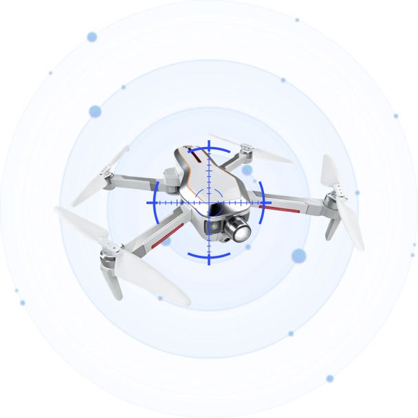
1. Radio frequency (RF) analyzers
RF analyzers listen for the conversation between a drone and its controller. Most commercial drones (DJI, Autel, Parrot) operate on known bands: 2.4 GHz, 5.8 GHz, sometimes 900 MHz or 1.2 GHz. If you know what frequency to listen for, you can hear the drone from a decent distance.
A decent RF system doesn’t just say ‘there’s a drone nearby.’ It identifies the model, logs the signal fingerprint, and can triangulate the controller’s position. Vendors in this space include Dedrone, CerbAir, and Rohde & Schwarz.
What RF can’t do: autonomous drones that don’t phone home, and anything flying on 5G or a proprietary mesh. The library problem is real, too. Every time DJI pushes a firmware update that changes how the protocol works, vendors have to reverse-engineer the new version and push an update. If you’re between updates, modified drones pass through.
LZ TECH takes a different approach with what they call CRPC, or Cognitive Radio Protocol Cracking. I’ll come back to this in detail later. It’s the most interesting thing in this space right now. The short version: instead of matching signals against a known library, CRPC tries to reconstruct the protocol itself, layer by layer. The claim is that it works on DIY and modified drones that library-matching misses. We don’t have independent test data to verify the full scope of that claim, but the technical direction makes more sense than simply building a bigger library and updating it faster.
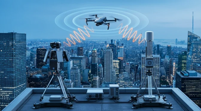
2. Radar
If RF is listening for the phone call, radar is shining a flashlight and waiting for the bounce.
Most radar is built for large, metal aircraft. Drones are small, slow, and often plastic. The radar cross-section of a DJI Mavic 4 is about 0.02 square meters. Standard air traffic radar filters this out as clutter.
Counter-drone radar is different. It uses micro-Doppler processing to look at the frequency shift created by spinning rotors, which distinguishes a drone from a bird. Robin Radar, whose white paper helped structure this guide, builds exactly this. Their IRIS system covers 360 degrees azimuth and 60 degrees elevation, purpose-built for drone signatures.
Radar tells you something is there. It doesn’t always tell you what it is or what it’s carrying. You need a second sensor, usually EO/IR, to confirm.
LZ TECH packages this as the TR100: phased-array radar with visible-light and thermal cameras in a single housing. Detection spec says 2 km or more for small drones. Whether that holds in your environment, urban clutter, high multi-path, depends on the site. I’d want to see a live demonstration before specifying it for a dense urban perimeter.
3. Electro-optical and infrared cameras (EO/IR)
EO/IR is the confirmation layer. Visible-light cameras give you the image. Thermal or infrared gives you the heat signature, which matters at night or in haze.
The problem with cameras: they need to know where to look. Pointing a camera at the empty sky isn’t a strategy. In practice, EO/IR almost always rides on top of a radar or RF cue. Radar says ‘drone at bearing 340 degrees, range 1.2 km.’ The camera gimbal slews to that azimuth and zooms.
AI is starting to change the economics. Instead of requiring an operator to stare at a screen, the system can flag potential drone signatures autonomously. LZ TECH’s VAR300 is positioned this way: active electro-optical scanning without an external cue. The T100 is the companion PTZ tracker, with a 6.1 mm to 561 mm focal length range. Narrow enough to resolve a drone model at several kilometers if the gimbal gets pointed in the correct direction.
For evidence collection, both systems matter. A thermal clip of a drone hovering near a restricted zone is worth more in a prosecution case than a radar track by itself.
4. Acoustic sensors
Drones make noise. Propellers at several thousand RPM generate a characteristic sound signature. A microphone array can triangulate the direction.
The strength: completely passive, works on autonomous drones that aren’t transmitting, and fills gaps in RF and radar coverage. The limitation: range is 300-500 meters at best, and it doesn’t work in high ambient noise. An airport apron is a terrible place for acoustic sensors. A quiet perimeter near a prison is a good one.
We think of acoustics as a gap-filler. If you’re already running RF and radar, adding a microphone array is relatively cheap insurance against the one drone type your other sensors might miss.
5. RF jammers
Jamming is the most widely deployed response technology today. The concept: transmit noise on the frequencies the drone uses to talk to its controller and receive GPS signals. The drone loses its link. What happens next depends on the drone’s fail-safe programming. It might land in place, return to its preset home point, or just drop.
That last option is why jamming near airports requires extreme care. An uncontrolled landing drone over a runway is a different problem than a hovering one over an empty parking lot.
The other limitation: jamming is indiscriminate by nature. You’re transmitting on broadband. If you’re near other wireless systems, medical equipment, other aircraft links, or ground communications, they may get caught in the blast. LZ TECH’s DFJ series tries to manage this with directional arrays. DFJ53 Max is the notable product: six-sided directional coverage with adaptive beamforming, intended to cover 360 degrees without creating a sphere of interference in every direction. Jamming range against mainstream UAVs is rated up to 3 km, though real-world performance varies by terrain and the target drone’s fail-safe behavior.
For handheld use, the HDJ 3.0 combines direction finding with jamming in a form factor that looks like a rifle antenna array. Hot-swappable battery matters here. If you’re on a patrol that lasts longer than your charge cycle, you want to swap batteries without losing jamming capability.
6. GPS spoofers
Spoofing is more surgical than jamming. Instead of breaking the link, you feed the drone false GPS coordinates. The drone thinks it’s somewhere else, and you can walk it toward a landing zone you control.
The limitations are significant. Spoofing only works on drones that rely on GPS for navigation. Most commercial drones do, but not all. It’s also regulated in most jurisdictions. In civilian contexts, operating a GPS spoofer without explicit authorization is generally not legal. This is primarily a military and law enforcement tool.
LZ TECH’s S series covers GPS, BeiDou, Galileo, and GLONASS, the four major GNSS constellations. The idea is to spoof whichever constellation the target drone is actually listening to. Whether this is deployable in your context is a regulatory question more than a technical one.
7. Protocol-level takeover
This is the technology we keep coming back to. It barely appears in most counter-drone buying guides, which tells you something about how early it still is.
The concept: if you can reverse-engineer a drone’s control protocol deeply enough, you can reconstruct the command stream and inject your own instructions. Don’t jam it. Do not spoof its GPS. Actually assume control of the link and tell the drone what to do.
LZ TECH calls this CRPC 3.0. The version numbering implies a progression. CRPC 1.0 was physical-layer demodulation: can you read the signal at all? CRPC 2.0 was an application-layer analysis: what’s the drone saying? CRPC 3.0 is a control-layer reconstruction: can you tell it to do something else?
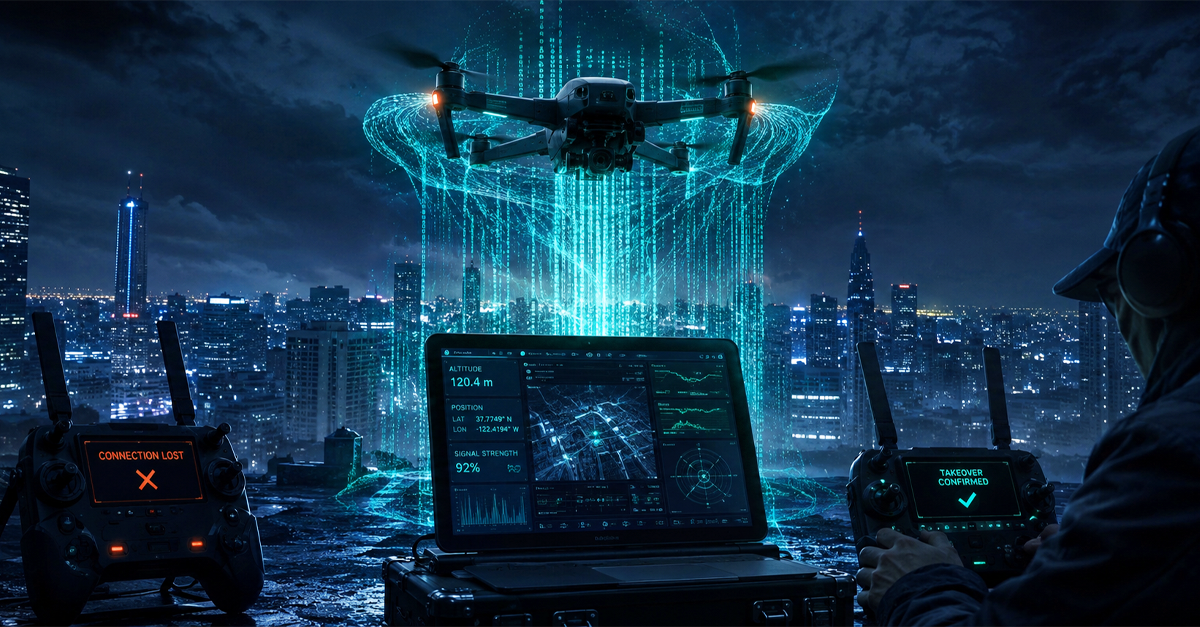
The Ruyi system is the operational deployment. The interface shows an operator a target drone and offers options: land it here, redirect it, or let it hover while you gather forensic data. The claim is a selective intervention. You’re having a conversation with one specific drone, not broadcasting into the spectrum.
We want to be honest: we can’t independently verify the full scope of these claims from the outside. What we can say is that the technical pathway is real. If you can crack the protocol, you can inject commands. The question is how many protocols any system can actually crack, and how quickly it adapts to updated firmware. LZ TECH says CRPC covers DJI, Autel, and ‘custom UAVs.’ That last claim is the interesting one. Everyone can handle DJI and Autel with enough engineering effort. The DIY and modified drones are the gap in every other system on this list.
8. Drone detection modules for OEM integration
This is a different product category. Instead of selling a finished counter-drone system, LZ TECH packages its detection engine into modules that third-party integrators can embed into their own platforms.
Three models. J3 is miniaturized. HJ1 combines detection and mitigation in one module. JV-1 is the high-performance version for demanding environments. All three carry CRPC technology in a form factor designed to fit inside another system.
We mention this because the counter-drone market is fragmented in a way that aviation security was never allowed to be. You’ve got radar vendors, camera vendors, RF vendors, jammer vendors, and C2 software vendors, and they all need to talk to each other, and they mostly don’t. LZ TECH is unusual in that they make the full stack itself, but also sell components to competitors and integrators. It’s a positioning choice that says: we think the detection engine is the foundational piece, and we’re willing to sell it to anyone building on top of it.
9. Command and control (C2) software
C2 is the software layer that ties everything together. If you have radar feeding tracks, RF feeding IDs, and cameras feeding video, C2 is where it all appears on one screen, gets correlated, and gets presented to an operator in a way that supports a decision.
The industry is moving toward sensor-agnostic C2. You don’t want to be locked into one radar vendor because your C2 can’t talk to anyone else. SAPIENT, a UK-initiated data standard for counter-drone systems, is trying to solve exactly this interoperability problem. ESG’s ELYSION, Dedrone’s DedroneTracker.AI, and Operational Solutions’ FACE are reference implementations.
LZ TECH’s CCS platform is their C2 entry. Real-time alarms, AI analysis, GIS panoramic display, and cross-region monitoring. The feature that stands out in their documentation is mission replay: a complete record of the engagement for after-action review, not merely a ‘drone detected’ log of the engagement for after-action review. Whether CCS competes with the best of breed on actual usability is something I’d want to test in a live evaluation before specifying it.
10. Multi-technology fusion systems
The reality most buyers figure out around month three of operations: no single sensor works all the time. RF misses silent drones. Radar confuses birds. Cameras need cueing. Acoustics don’t reach in noisy environments.
Fusion systems package multiple sensors into one coherent deployment. LZ TECH’s Multi-technology Fusion Detection Solution claims up to 10 km RF detection range and includes API interfaces for third-party integration. The Interception Defense System variant adds the response layer: jamming, spoofing, or protocol takeover, depending on configuration and authorization.
This is where the industry is heading. The question isn’t which sensor is best; it’s how to fuse them in a way that an operator can actually use under stress. The technical challenge isn’t the sensors. It’s the correlation layer that takes five different data streams and turns them into one actionable picture.

How to choose the right solution
There isn’t a universal answer. But some frames help.
If you’re protecting a fixed site, say an airport, prison, power plant, or government building, you probably want layered static sensors. Radar as the early warning layer, RF as the identification layer, EO/IR as the confirmation layer, and jamming or takeover as the response layer. All four if the budget allows. LZ TECH’s DS Series covers the detection side for fixed deployments. The right configuration depends on your threat model: what drone types are you actually defending against?
If you’re mobile, convoy, VIP movement, border patrol, portable, and vehicle-mounted systems are the relevant category. LZ TECH’s VM system is built for this: detection and response while moving at up to 80 km/h. IP66 protection and operation from minus 40 to plus 60 degrees Celsius means it’s deployable in most climates without environmental enclosures.
If you’re on foot, event security, perimeter patrol, tactical response, handheld and portable systems are the relevant form factor. H3 Pro is the positioning specialist: handheld, 6-inch screen, 800 MHz to 5.8 GHz frequency coverage. HD5 is the broader portable system with a 13.3-inch touchscreen and a hot-swappable battery. Both can be set up and operating in under five minutes by a trained operator.