For years, the counter-drone industry has been described as emerging, growing, and on the verge of a breakout. Those descriptions were accurate for a market where most activity consisted of pilot programs, trial deployments, and small-scale procurements by early-adopter government agencies. In 2026, the evidence suggests the market is no longer emerging. It is accelerating into a phase of institutional procurement and industrial scale.
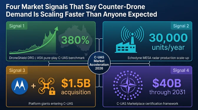
Four signals from the first half of 2026 make the case. They come from different corners of the industry: a publicly traded pure-play counter-drone company, a radar manufacturer committing to volume production, a major acquisition by a public safety technology company, and a multilateral defense procurement framework. Each signal is meaningful on its own. Together, they describe a market that has moved from pilots to programs.
Signal 1: DroneShield’s Revenue Growth Shows Institutional Procurement at Scale
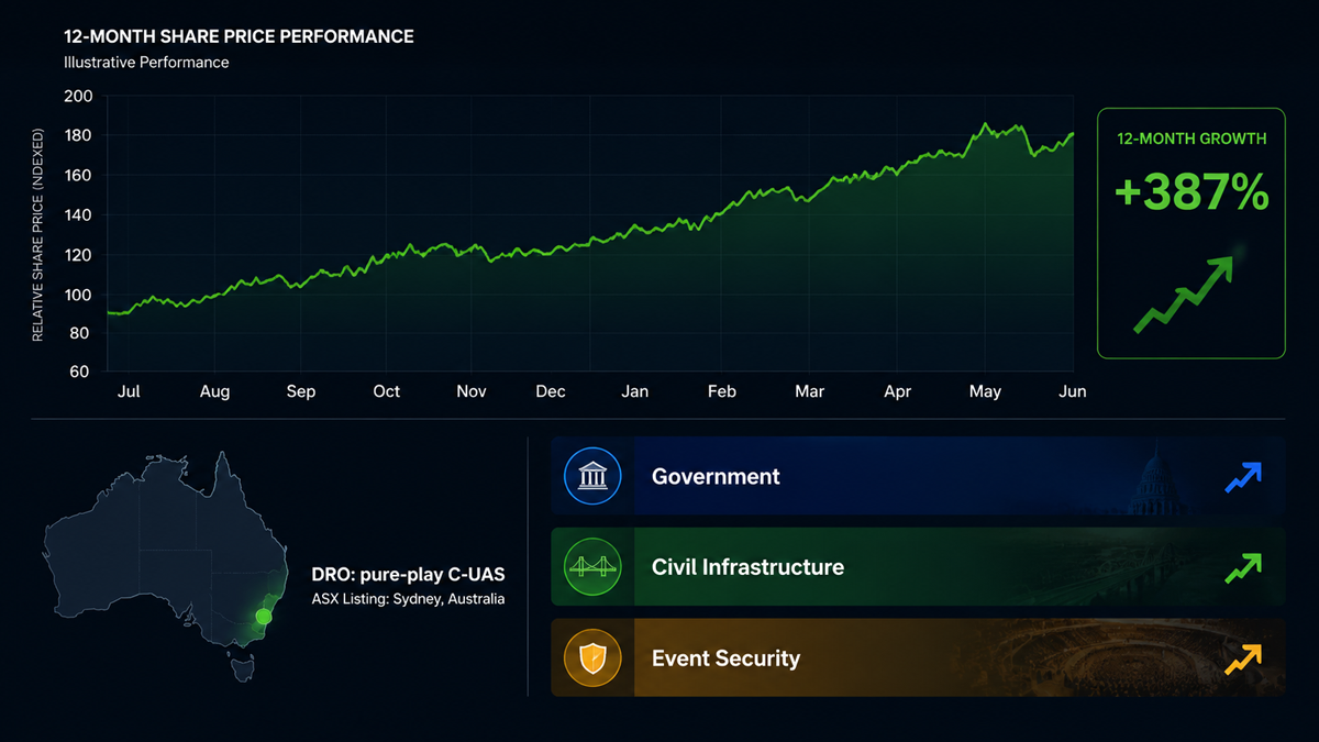
DroneShield, the Australian counter-drone company listed on the Australian Securities Exchange, has reported significant revenue growth over the past several years. The company’s trajectory is notable because it is one of the few pure-play counter-UAS companies with publicly available financial data. Its growth rate provides a window into how quickly government procurement budgets for counter-drone systems are expanding globally.
The company’s revenue has grown at triple-digit percentage rates in recent reporting periods. This is not the growth profile of a company winning a handful of evaluation contracts. It is the profile of a company converting pilot programs into recurring procurement orders. Government customers that previously bought a few units for testing are now ordering systems for operational deployment across multiple sites and, in some cases, across multiple branches of their security forces.
The pattern is consistent across DroneShield’s geographic markets. The company has reported contracts in North America, Europe, the Middle East, and the Asia-Pacific region. The diversity of its customer base suggests that the shift from evaluation to procurement is not limited to one country or one type of end user. It is a global phenomenon.
For the broader counter-drone industry, DroneShield’s financial results serve as a public benchmark. If the only pure-play public company in the sector is growing at triple-digit rates, it strongly suggests that privately held competitors are experiencing similar demand. The rising tide is lifting multiple companies, not just one.
What makes this signal particularly meaningful is that government procurement cycles are slow by nature. A defense or security agency typically takes 12 to 24 months to move from initial evaluation to a signed procurement contract, and another 6 to 12 months to receive and deploy equipment. The growth that DroneShield is reporting now reflects procurement decisions that were initiated two to three years ago. If those early decisions are now converting to revenue at scale, the procurement pipeline for the next two to three years is likely even larger, because the number of agencies that have begun evaluation programs has only increased since then.
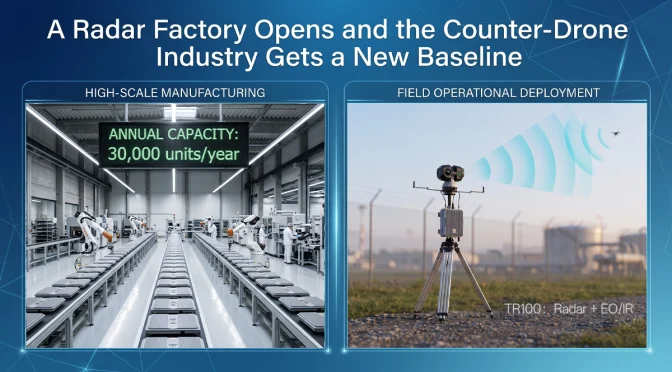
Signal 2: Echodyne’s 30,000-Unit Radar Factory Signals Industrial-Scale Production
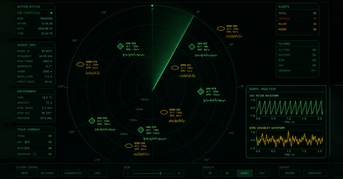
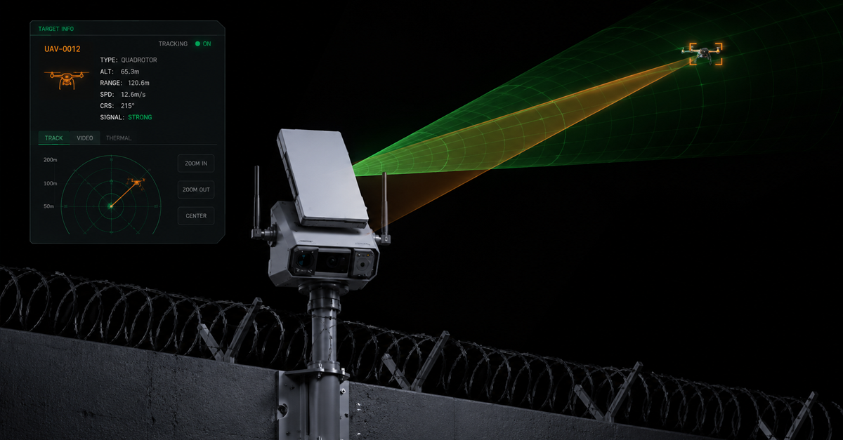
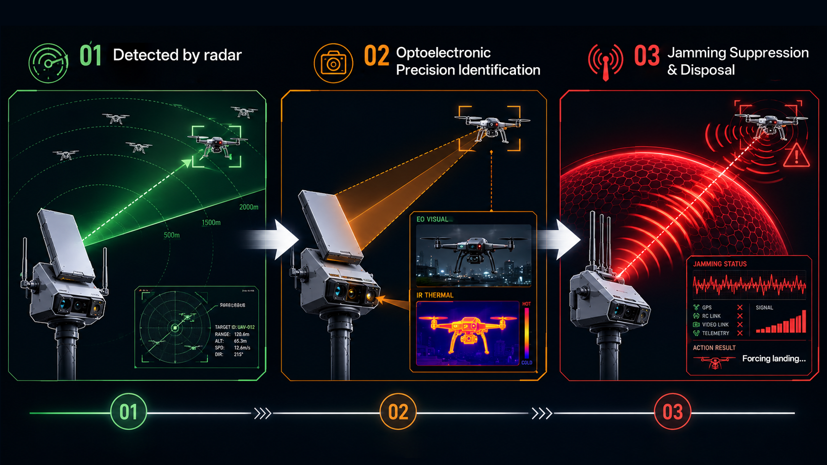
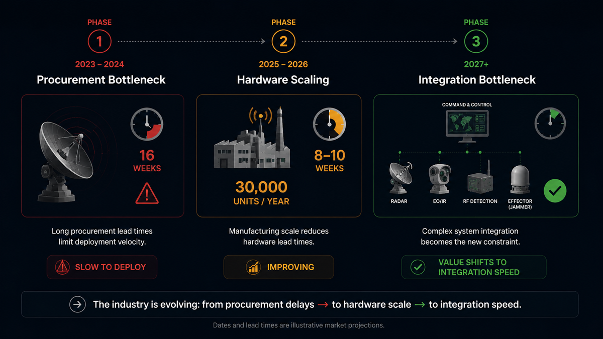
As discussed in more detail in our separate analysis of the TR100 integrated radar platform, Echodyne opened a new production facility in 2026 with an annual capacity exceeding 30,000 MESA radar units. The MESA radar is a compact phased-array system used extensively for drone detection, perimeter security, and border surveillance applications.
A 30,000-unit annual capacity is not a facility sized for boutique defense programs that order radar systems in dozens or low hundreds. It implies that the manufacturer expects demand at a scale that did not previously exist for this class of sensor. For comparison, a typical large defense radar program might order 200 to 500 units over a five-year period. Thirty thousand units per year is two orders of magnitude larger than that.
The investment in volume production capacity is a bet that counter-drone radar will become standard equipment at critical infrastructure sites worldwide, not a specialized capability reserved for high-value military installations. If that bet is correct, the addressable market for this class of sensor will expand dramatically within the next several years.
The factory expansion also has implications for unit economics. Volume production drives down per-unit cost through manufacturing efficiency, supply chain optimization, and amortization of fixed costs over a larger production base. Cheaper radar units expand the addressable market further by making the technology accessible to budget-constrained customers such as municipal police departments, private security firms, and smaller critical infrastructure operators. This creates a virtuous cycle: more production lowers unit cost, which expands the market, which supports more production.
For counter-drone system integrators like LZ TECH, the availability of more affordable radar sensors from multiple suppliers is a positive development. It means that integrated detection systems can be priced at levels that a broader range of customers can afford, accelerating the overall market growth that benefits the entire industry.
Signal 3: Motorola Solutions Acquires D-Fend Solutions for Approximately $1.5 Billion
In June 2026, Motorola Solutions announced the acquisition of D-Fend Solutions, an Israeli counter-drone company known for its radio-frequency cyber-takeover technology, for approximately $1.5 billion. This is the largest acquisition in the counter-drone sector to date, and it carries several implications for the market.
First, the acquirer matters as much as the price. Motorola Solutions is a public safety and enterprise security company, not a defense prime contractor. Its customer base consists of police departments, fire services, airports, utilities, and corporate security teams. Motorola sells two-way radios, body cameras, command-center software, and video security systems to thousands of public safety agencies worldwide. The decision to acquire a counter-drone company signals that Motorola sees drone threats as a mainstream public safety problem that its existing customers need to address, not a niche military concern.
Second, the $1.5 billion valuation demonstrates that the financial market now places counter-drone technology companies in the same category as established security technology firms. A billion-dollar acquisition in this sector would have been considered unlikely even three years ago. Today, it has happened. This changes how investors, potential acquirers, and company founders think about the value of counter-drone technology businesses.
Third, Motorola’s distribution network is one of the most extensive in the public safety industry. The company has direct sales relationships with thousands of law enforcement agencies, airport authorities, and critical infrastructure operators across more than 100 countries. D-Fend’s counter-drone technology, combined with Motorola’s sales channels and existing customer relationships, could accelerate the adoption of counter-drone systems by local and regional agencies that have not previously had practical access to this class of equipment.
Fourth, the acquisition signals that counter-drone technology is being absorbed into the broader public safety technology stack. Rather than existing as a standalone discipline with specialized vendors, drone defense is becoming one module within an integrated security platform. Motorola’s command-center software, video management systems, and communication platforms will likely integrate D-Fend’s drone detection and mitigation capabilities, creating a unified security operations interface that includes counter-drone as a standard feature.
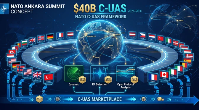
Signal 4: NATO’s $40 Billion C-UAS Marketplace Framework
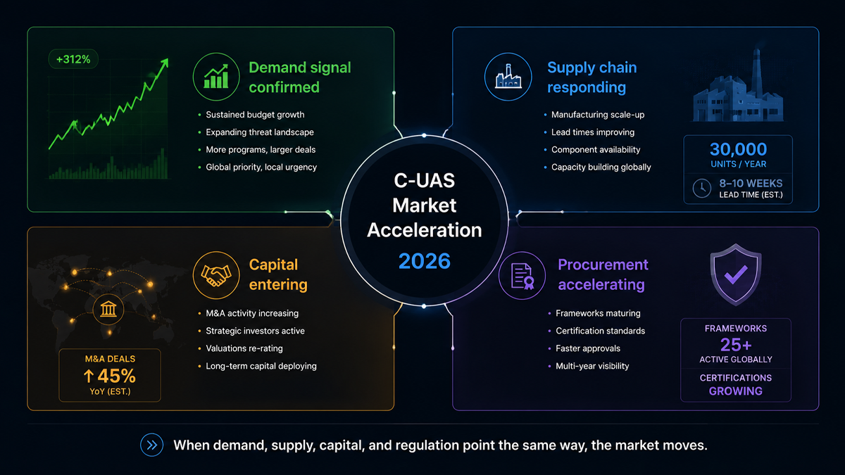
NATO has established a Counter-UAS Marketplace framework with a reported total value of approximately $40 billion. The framework is designed to streamline procurement of counter-drone systems across NATO member states, reducing the administrative overhead of individual national procurement programs and enabling interoperability between allied counter-drone systems.
The significance of this framework extends well beyond the headline dollar figure. It represents a formal recognition at the alliance level that counter-drone capability is now a baseline requirement for modern military forces, comparable to armored vehicles, communication systems, or electronic warfare equipment. A multilateral procurement framework of this size would not be established for a capability that NATO considered experimental or optional.
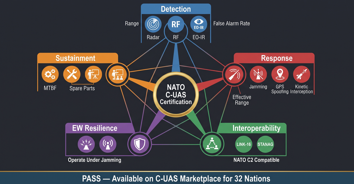
The framework approach addresses a long-standing problem in defense procurement: fragmentation. Historically, each NATO member state has procured counter-drone systems independently, using its own requirements, its own testing standards, and its own contract vehicles. This results in a patchwork of incompatible systems that cannot share data, cannot coordinate responses, and cost more to acquire and maintain because each national program bears its own overhead.
A centralized marketplace framework solves these problems in several ways. It establishes common technical standards that all participating systems must meet. It creates a pre-qualified vendor list that reduces the procurement timeline for individual member states. It drives interoperability by requiring that all systems procured through the framework can exchange data and coordinate operations. And it aggregates demand, giving NATO member states collective purchasing power that individual nations cannot achieve alone.
For counter-drone manufacturers, a procurement framework of this size creates a structured and predictable market. Companies that can meet NATO’s technical and interoperability requirements gain access to a pipeline of orders across multiple member states. Instead of competing separately in 30 different national procurement processes, they qualify once and are listed for all participating nations. This dramatically reduces the sales cost and timeline for accessing NATO markets.
The framework also encourages investment in research and development. A company that knows it has a clear path to market for a system that meets NATO standards is more likely to invest in developing that system. The framework reduces the risk that a technically superior product will fail commercially because the manufacturer could not manage dozens of separate national procurement bureaucracies.
What These Four Signals Mean Collectively
Viewed individually, each of these signals could be dismissed as a single data point. A company reports strong revenue. A manufacturer expands a factory. Another company gets acquired by a larger player. A military alliance sets up a procurement framework. Any one of these events, on its own, is interesting but not conclusive.
Viewed together, they describe a market that is crossing an important threshold. The counter-drone industry is moving from a collection of technology demonstrations and small-scale deployments to an established sector with institutional buyers, billion-dollar valuations, volume manufacturing, and multilateral procurement structures. The market infrastructure that supports large-scale industrial activity is being built: standardized requirements, pre-qualified vendor lists, interoperable architectures, and distribution channels that reach thousands of end-user organizations.
The practical implication for end users is that counter-drone equipment is becoming more accessible, more standardized, and more interoperable. The days of every deployment being a bespoke integration project are numbered. The practical implication for the industry is that the window for entering the market as a new participant is narrowing. Companies that already have production hardware, established supply chains, and field-proven technology are positioned to capture the procurement wave that is now building. Companies still in the prototype phase face an increasingly competitive field with higher barriers to entry.
LZ TECH’s Position in the Accelerating Market
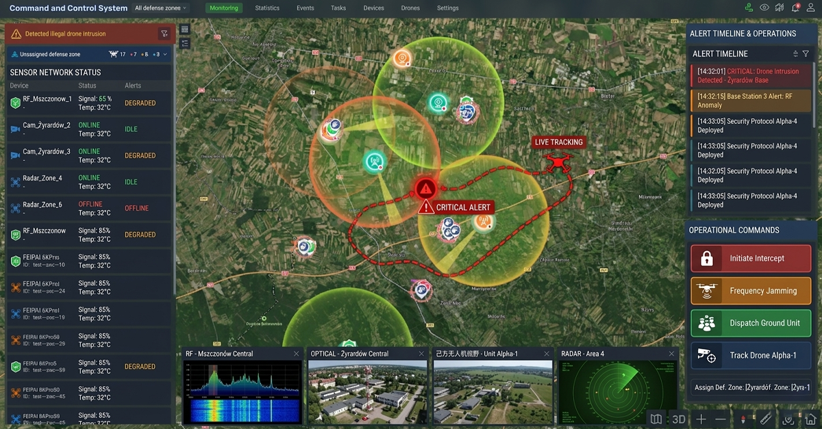
LZ TECH has been building counter-drone detection and defense systems for the global market since its founding. The company supplies OEM modules to system integrators, operates the CCS command-and-control platform for multi-sensor integration, and has established a presence in over 60 countries with more than 6,000 partners.
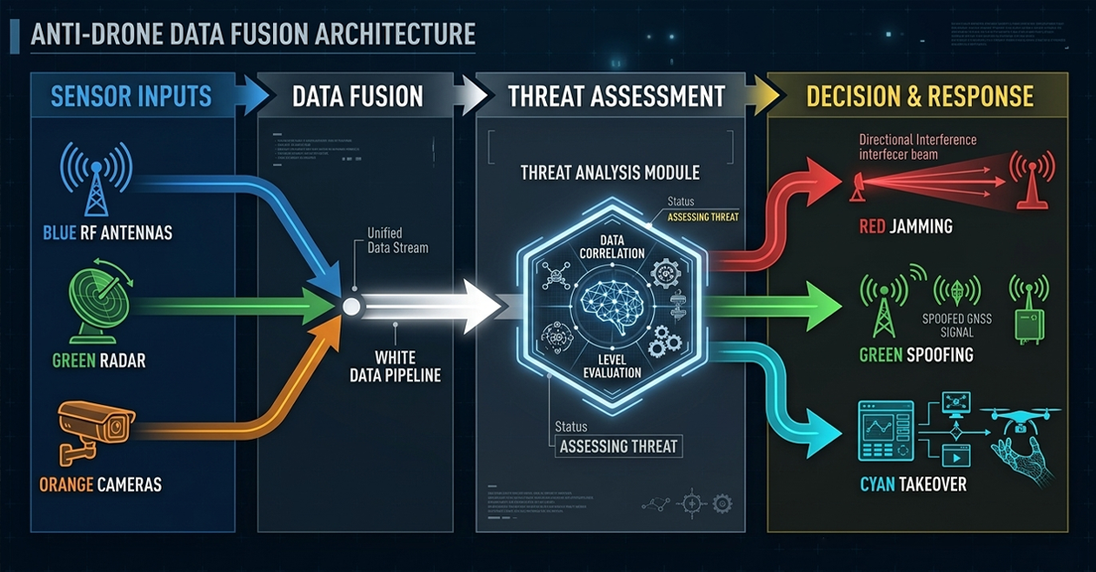
The product portfolio spans portable detection devices like the H3 Pro and HD5, integrated radar and EO/IR platforms like the TR100, and a range of RF detection and jamming modules that system integrators can incorporate into their own solutions. The CCS platform provides the software layer that connects these sensors into a unified operational picture, handling sensor fusion, alert prioritization, and automated response workflows.
As the market accelerates from pilots to procurement, the companies that succeed will be those with production-ready hardware across multiple sensor categories, established global distribution and support networks, and a software platform that integrates sensors from different manufacturers. LZ TECH has invested in all three areas over multiple years and across multiple product generations. The company is positioned to supply both end-user organizations that need complete systems and integrators that need OEM modules to build their own solutions, serving customers ranging from national defense agencies to commercial security providers operating at airports, ports, and energy facilities.
What to Expect Through the End of 2026 and Into 2027
The four signals described above are unlikely to be the last major market developments in 2026. Several trends suggest continued market acceleration.
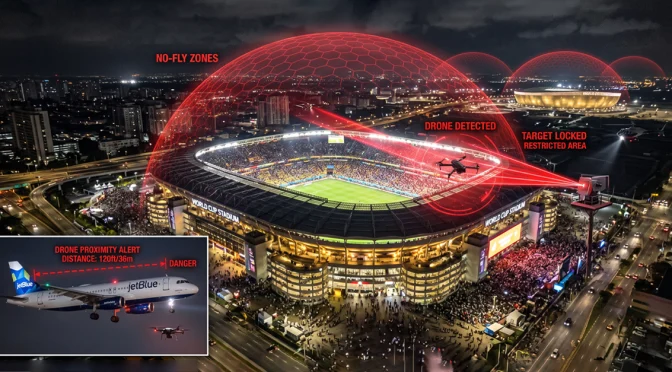
Regulatory mandates for drone detection at critical infrastructure sites are under active consideration in multiple jurisdictions. The European Union, the United Kingdom, several Middle Eastern states, and parts of Asia are developing or have recently enacted regulations that require certain categories of infrastructure operators to maintain drone detection and response capability. If these mandates continue to expand, they will create a new category of demand from civilian infrastructure operators who have not previously been buyers of counter-drone equipment. This is a large addressable market that has barely been tapped.
The growing availability of counter-drone systems at price points accessible to municipal police departments and private security firms will further expand the addressable market beyond national defense agencies. Motorola’s entry into the market through the D-Fend acquisition is a leading indicator of this trend. When counter-drone capability becomes available through the same sales channels that supply police radios and body cameras, adoption by local law enforcement will accelerate rapidly. A police department that already buys Motorola radios is a natural customer for a Motorola-integrated counter-drone solution.
Standardization of sensor interfaces and command-and-control protocols, driven by frameworks like the NATO C-UAS Marketplace, will reduce integration costs and make it easier for end users to combine sensors from multiple manufacturers. This benefits the entire industry by reducing the friction of deploying multi-sensor systems and by creating a larger market for interoperable components. It also benefits end users by giving them more choice: a standardized interface means they can select the best sensor for each function rather than being locked into a single vendor for all components.
The counter-drone market in 2026 is not what it was in 2023. The evidence from financial markets, manufacturing investment, merger and acquisition activity, and defense procurement frameworks all points in the same direction. The industry is entering its next phase, and the companies that built production capability and global distribution during the earlier pilot phase are the ones positioned to supply the procurement wave that is now arriving.
For end users evaluating counter-drone solutions, the market conditions described here have practical implications. More competition and larger production volumes mean better equipment at lower cost. Standardized procurement frameworks mean faster acquisition timelines. Integration with established public safety platforms means simpler deployment and lower training requirements. The maturation of the counter-drone market is good news for the organizations that need these systems to protect their people, assets, and operations from drone threats that continue to grow in number and sophistication.
The counter-drone industry has spent the better part of a decade building the technology foundation. Now the market infrastructure is catching up: procurement frameworks, integration standards, distribution channels, and the institutional awareness needed to turn technical capability into operational deployment. The next chapter of this industry will be written not in research labs, but in the field.
 a
a
-672x372.webp)
-672x372.webp)